
SmartFleetDX Manage


MANAGE YOUR EQUIPMENT. ALL MACHINES. ALL BRANDS. ALL LOCATIONS.
SmartFleetDX Manage is a powerful digital platform that centralises all your equipment data, regardless of the brand. It allows you to easily access and maintain important documentation, history and location of your equipment from anywhere, anytime, maximising efficiency and control.
All your information on one digital platform.
Keep an eye on your fleet’s activity to ensure your machines are always producing.
Create a digital twin of your machine so you can follow its production and maintenance schedule and react to alerts on time.
Boost organisation and efficiency in your jobsite with planning that details when and where your machine should be at all times.
Quick and easy document sharing with your operators and maintenance engineers.
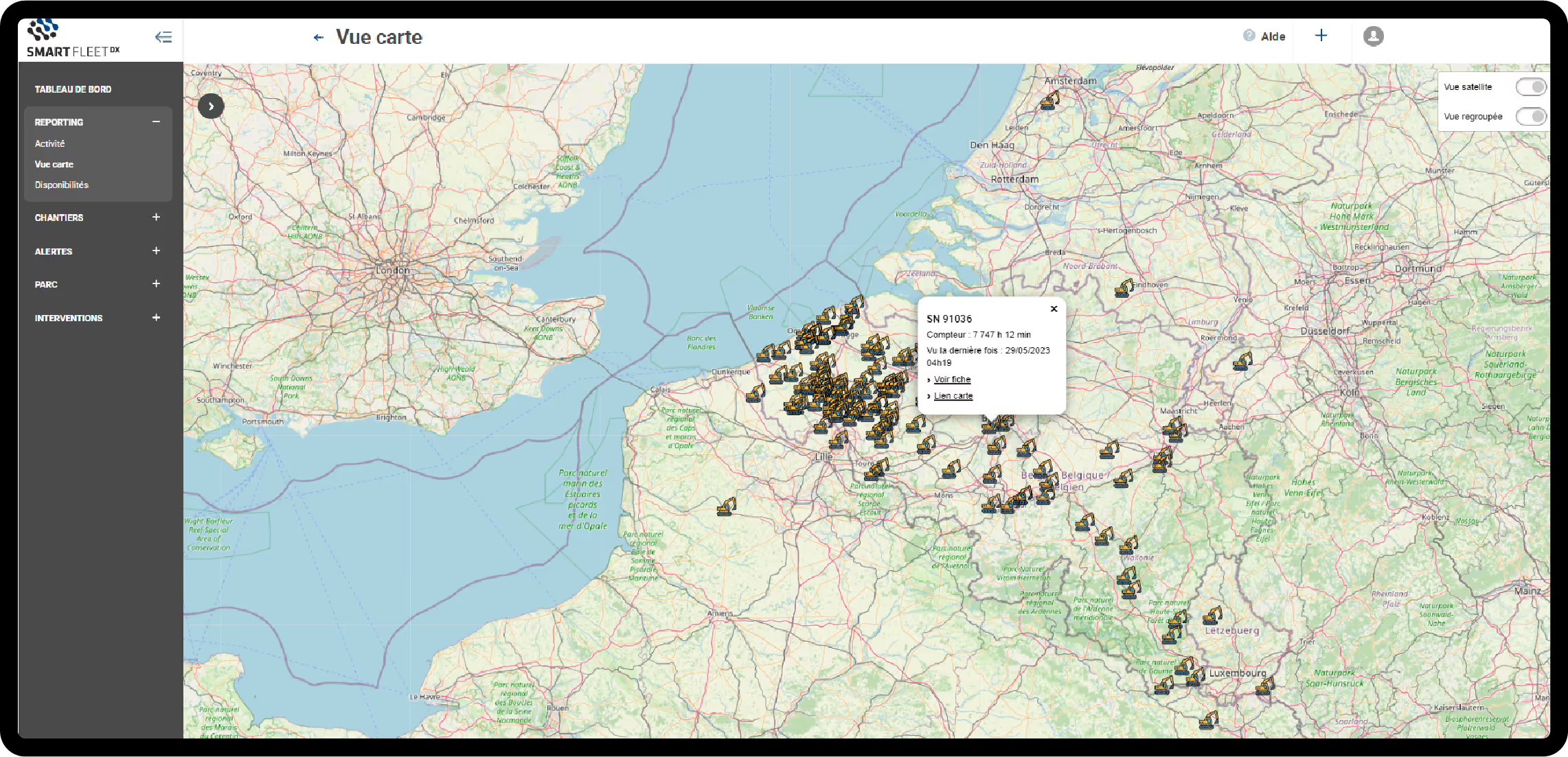
Always have an overview of your jobsites and track which assets are working for you through geolocalisation.

360° Overview
A comprehensive overview of your machine’s operating hours, idle time, maintenance schedule, and geolocation.
Fleet Planning Overview
Fleet Maintenance Overview
Fleet Operating Time Overview
Basic Telematic Data
Maintenance Alerts

Digital Twin
Centralised equipment administration access that enables you to manage certification and equipment allocation from your smartphone or computer.
Equipment digital twins keep you informed of their health, maintenance needs, planning and operating hours
A centralised data platform for convenient real-time access to equipment documentation and history logs
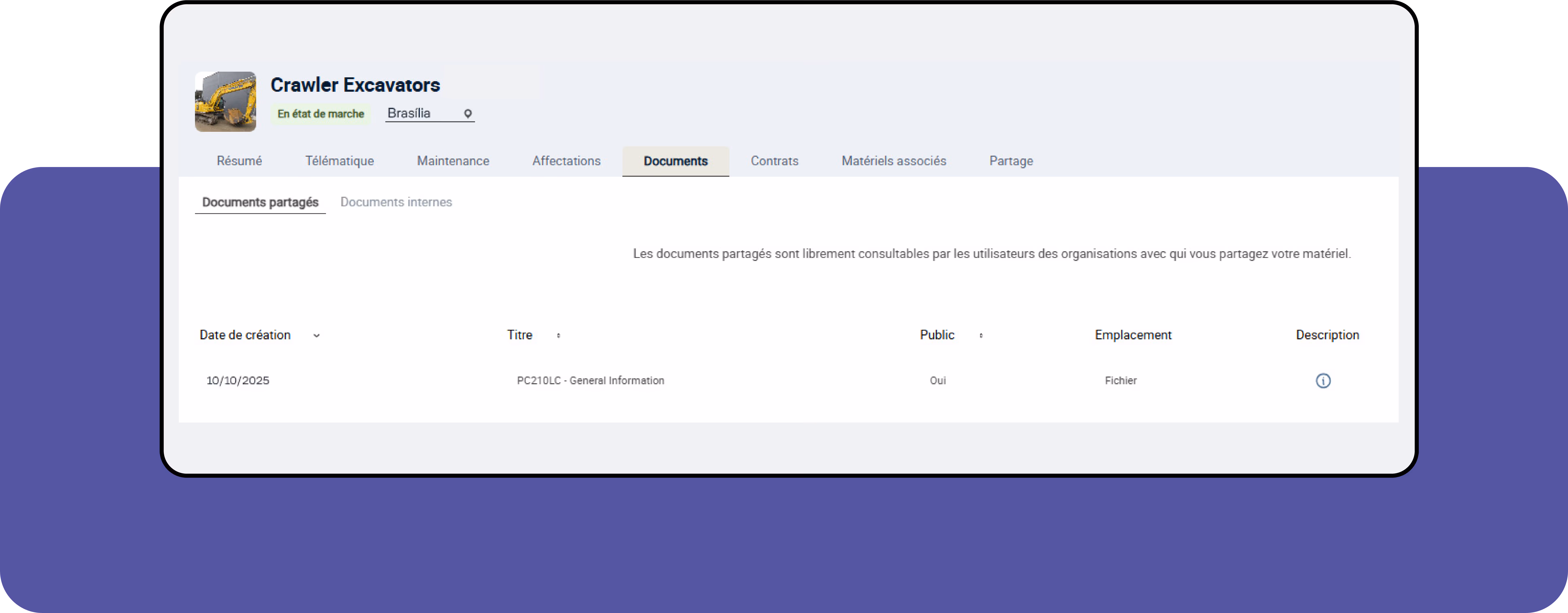
Ad hoc Document Exports
Easily share equipment data and dedicated maintenance information with operators and maintenance engineers.

SmartFleetDX Support
Get remote and onsite support from SmartFleetDX representatives to solve all your challenges and issues as quickly as possible.
Maintenance planning advice
Remote application support
Surveyors and contractors alike use MAGNET Field to collect points, stake out road and site projects, lay out building components, and perform land surveys.
Ability to calculate, contour, and compare surfaces.
Surface staking with automatic Digital Terrain Model creation.
Colorised cut-and-fill indicator and volume calculations.
A secure cloud environment that connects your office and field teams improving your communication and collaboration. Use any web browser to view your data on a map, view redline models, and measure areas and distances.
View connected Topcon devices and transfer real-time data.
See a visual map of projects and geo-referenced datasets.
Seamlessly connect to Topcon’s MAGNET Field and Survey products.
Draft and design property plots, subdivision designs and land-development projects. Process data within an intuitive drafting environment and create simplified or detailed drawing layouts.
Full range of sub-division design tools.
Contour and surface creation, volumetrics and automated pad design.
User-defined title blocks, symbols and line types.
