
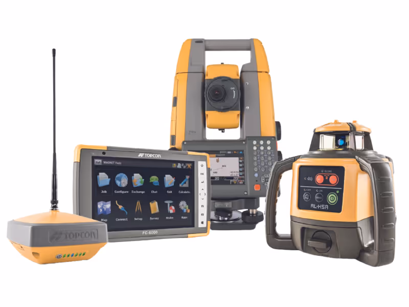
Topcon offers a range of innovative, integrated hardware solutions for surveying as well as software andmobile solutions that are compatible with all site conditions and easy tomanage.


No items found.


No items found.
SMARTER, MORE PRECISE SURVEYING
Achieve accurate measurements and a smooth flow of data from the field to the office, enabling faster and more reliable project delivery.
What is Surveying?
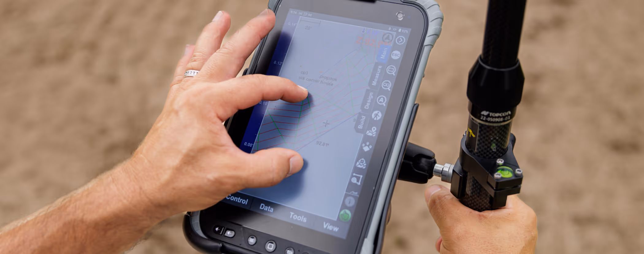
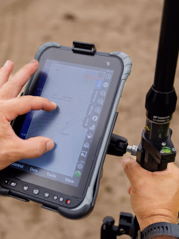
Surveying provides accurate measurements and detailed spatial data, laying the groundwork for successful design, construction, and site management. Our advanced surveying technologies facilitate precise positioning, efficient data collection and smooth collaboration, helping your teams to measure, stake out and monitor projects with confidence, ensuring that deadlines and budgets are met.
Real-time data collaboration
Share measurements and progress instantly between field crews and office teams to enable faster decision-making and reduce rework.
Integrated hardware and software
Streamline workflows from field data capture to office processing by using rugged, user-friendly instruments alongside intuitive software.
Hybrid GNSS and total station control
Enhance productivity by integrating GNSS with total stations to allow for fewer setups and accurate data capture, even without a clear line of sight.
Accurate positioning and measurement
Use GNSS receivers, total stations and laser scanners to capture precise single points and 3D point cloud data in challenging site conditions.
Smart Fleet Solutions
Connect, monitor and manage your assets more efficiently with our comprehensive digital fleet solutions.
Why choose SmartFleetDX?
Achieve global visibility to proactively maximise sustainability while maintaining operational excellence. Backed by expert teams and advanced analytics, you can make smarter, more environmentally friendly decisions.
Key Benefits:
• Start-stop system reduces engine idle time (20% to 40% fuel savings)
• Decrease in engine operating hours
• Reduction in fuel consumption, and thus GES emissions
• Lower maintenance costs
• Reduced engine and major component wear
• Extended machine lifespan
• Improved productivity (litres/tonne)
Are you ready to improve the accuracy and efficiency of your surveying?