
SmartFleetDX Live


Optimise your operations
SmartFleetDX Live is a powerful data-driven mine management tool designed specifically for the mining and quarrying industry. It enables you to follow activities in real time, stay on track and reach your production goals. Advanced asset tracking and performance analysis technology provides valuable insights into your equipment's health, regardless of the brand or model.
Follow all production cycle data organised on an easy to read digital dashboard.
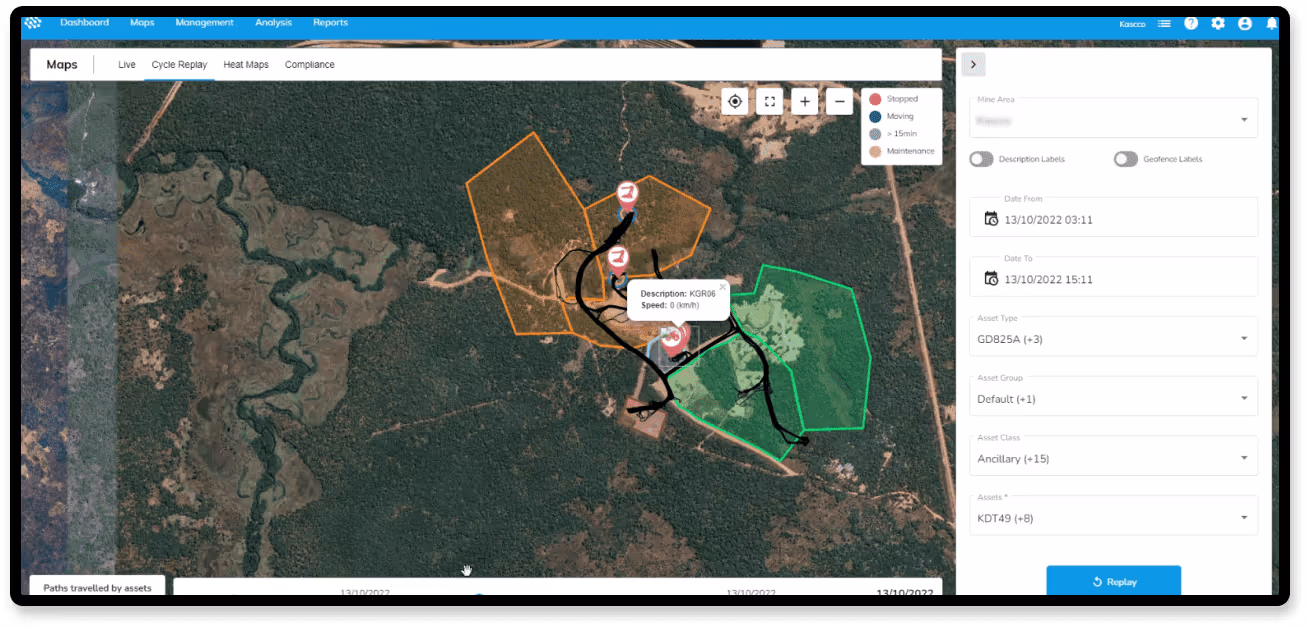
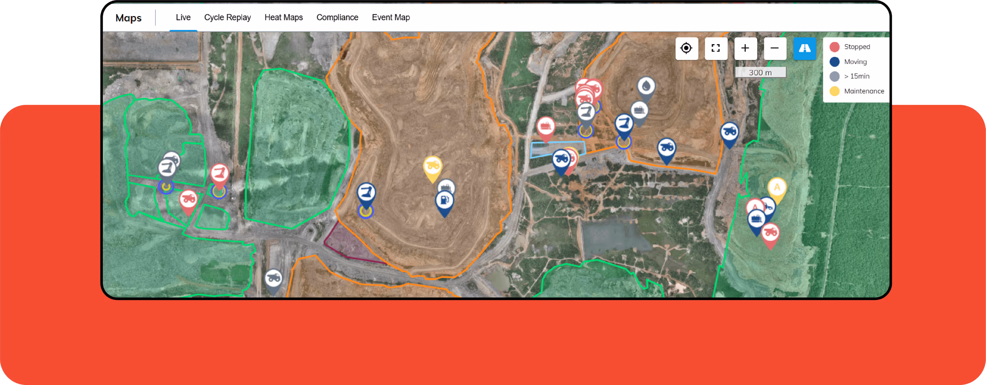
A live overview of each machine’s location, fuel consumption, average speed, idle time, health, and productivity.
Follow the performance of your operators so you can intervene at the right time.
Look into past production cycles and replay incidents to avoid future delays and issues.
Our team of experts is always available to help boost the optimisation your production cycles, machine usage, and safety.
Get predictive warnings on potential safety and damage risks before they interfere with production.
Get regular insight reports tailored to your unique data analysis needs.
Fleet Production Insights
Heighten production efficiency across all connected job sites by monitoring opportunities for improvement.
Live production data overview
Fleet production data dashboard
Live location and visual machine tracking
Event replay abilities

Machine Usage Insights
Maintain optimal asset health conditions, productivity, safety, and residual value through continuous monitoring.
Cycle efficiency measurements
Live speed and idle time measurements
Live machine monitoring
Machine performance and misuse reports
Machine performance benchmarks
Operator performance overviews
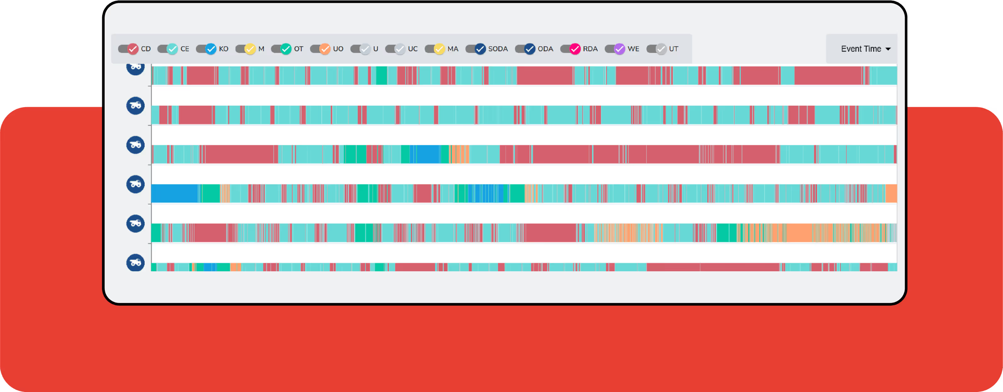
Delay management
By effectively managing delays, organizations have the ability to transform non-productive times into valuable operational or maintenance events

SmartFleetDX Support
Get remote and onsite support from SmartFleetDX representatives to solve all your challenges and issues as quickly as possible.
Machine-use Consultation and Advice from Industry Experts
Market Benchmarks on important KPIs
Maintenance Reports with Actionable Insights
Surveyors and contractors alike use MAGNET Field to collect points, stake out road and site projects, lay out building components, and perform land surveys.
Ability to calculate, contour, and compare surfaces.
Surface staking with automatic Digital Terrain Model creation.
Colorised cut-and-fill indicator and volume calculations.
A secure cloud environment that connects your office and field teams improving your communication and collaboration. Use any web browser to view your data on a map, view redline models, and measure areas and distances.
View connected Topcon devices and transfer real-time data.
See a visual map of projects and geo-referenced datasets.
Seamlessly connect to Topcon’s MAGNET Field and Survey products.
Draft and design property plots, subdivision designs and land-development projects. Process data within an intuitive drafting environment and create simplified or detailed drawing layouts.
Full range of sub-division design tools.
Contour and surface creation, volumetrics and automated pad design.
User-defined title blocks, symbols and line types.
